Will Fair

Soil and Sediment Assessment Calculator

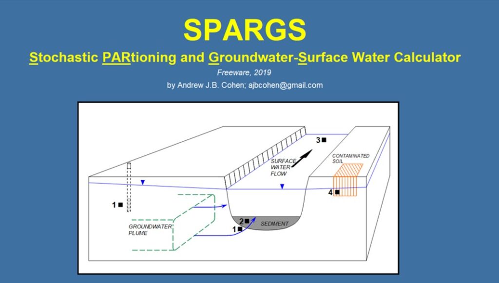
Developed SPARGS (Stochastic Partitioning Groundwater-Surface water calculator), used to quantify groundwater plume discharge and subsequent surface water dilution, chemical partitioning in sediment, and assessment of residual NAPL in soil samples. The calculator is a spreadsheet-based program constructed as a stand-alone software application, and has an easy user interface, Monte Carlo analysis, and lookup tables.   […]

Soil and Sediment Assessment Calculator Read More »

Groundwater Plume Discharge to Surface Water and Sediment Investigation

Assessed the distribution, sources, and transport mechanisms of chlorofluorocarbons (e.g., Freon), chlorinated solvents, and gasoline antiknock chemicals into the Delaware River (river sediment and surface water), and in an aquifer beneath the Delaware River. Analyzed data collected over 2.5 miles of coastline, including results of dual frequency echo-sounder for bathymetric mapping, side-scan sonar to map

Groundwater Plume Discharge to Surface Water and Sediment Investigation Read More »

Contaminated Sediment Investigation, Modeling, and Remediation

Investigation, design, Conceptual Site Model development, and remedial selection for sediment contaminated with VOCs and aniline. Project included high-resolution profiling of sediment pore water concentrations, sediment pore water transport modeling, bench-scale tests to assess efficacy of a Geosynthetic Bentonite Liner cap, and design of a sheet pile barrier to prevent groundwater plume discharge to surface

Contaminated Sediment Investigation, Modeling, and Remediation Read More »

DNAPL Assessment Toolbox

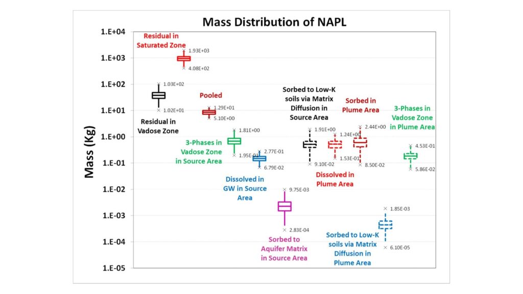
Developed Excel-based VBA program used to assess if NAPL is present in the subsurface based on user-defined soil, groundwater, or soil gas concentrations. Program also performs estimates of NAPL mass distribution (free-phase, dissolved, vapor, and sorbed) and considers the uncertainty of chemical and field properties via Monte Carlo calculations.       The Excel-based tool

DNAPL Assessment Toolbox Read More »

Plume Degradation Analysis via CSIA and PFAS Evaluation

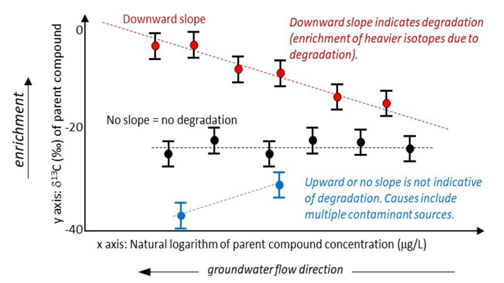
Evaluated PCE, TCE, and cis-DCE concentration data via Compound Specific Isotope Analysis (CSIA) to provide additional line of evidence that a groundwater plume is degrading and that the VOCs detected in private wells originate from an upgradient landfill.   The CSIA method was used to analyze carbon (δ¹³C) and chlorine (δ³⁷Cl) isotopes in PCE, TCE,

Plume Degradation Analysis via CSIA and PFAS Evaluation Read More »

Hazardous Waste Landfill – Data Evaluation and Conceptual Site Model Development

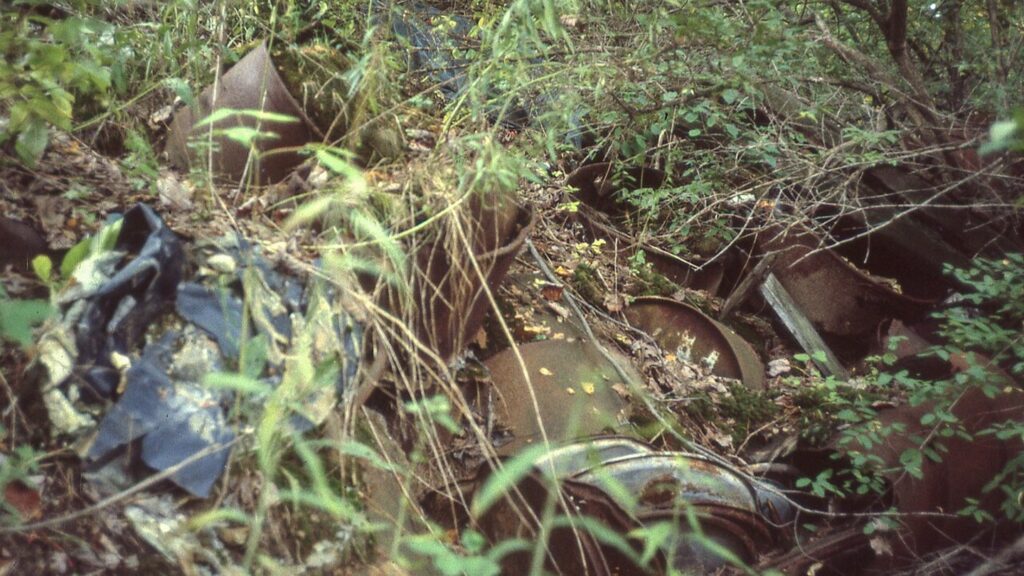
Engaged to develop a Conceptual Site Model (CSM) for the Landfill Superfund Site. The CSM was constructed using a multiple lines-of-evidence approach, integrating historical and contemporary soil, groundwater, sediment, and surface water data to evaluate contaminant fate and transport.   Key Findings included Identification that a former sludge disposal area and 2,000 buried drums were

Hazardous Waste Landfill – Data Evaluation and Conceptual Site Model Development Read More »

PFAS Site Characterization – Petroleum Refinery

Evaluated extensive PFAS dataset that includes groundwater, surface water impoundments, wastewater treatment plant influent/effluent, groundwater treatment system influent/effluent, outfalls, and stream and river samples to determine impacts of site discharges to surface water quality. Analysis of PFAS chemical signatures and hydrogeologic details enabled attribution of PFAS present beneath the site to have originated from another

PFAS Site Characterization – Petroleum Refinery Read More »

High Resolution Site Characterization – Fractured Rock Aquifer

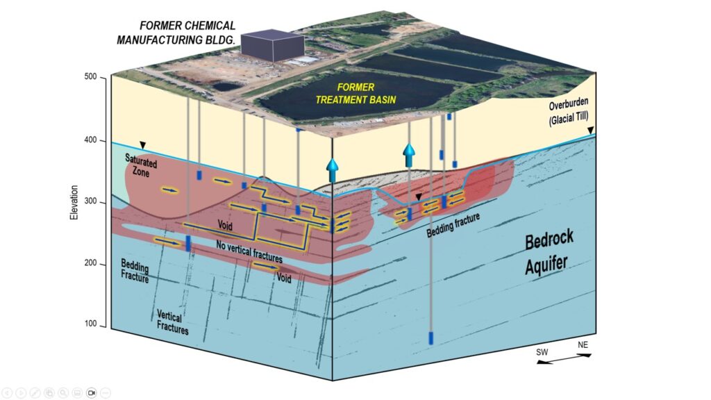
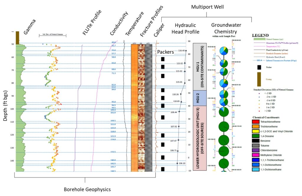
High-resolution site characterization of contaminated groundwater in fractured and faulted sandstone (Passaic Formation). Integration of large dataset including chemical and hydraulic data from 1,100 wells, 19,800 soil samples from 9,000+ locations, multiport wells (19 to 24 ports/well), surface and borehole geophysics (110 borings), rock coring, and integration of on-site and off-site historical records. Bedrock aquifer

High Resolution Site Characterization – Fractured Rock Aquifer Read More »

Author: Hydrogeologic Characterization of Fractured Rock Formations – A Guide for Groundwater Remediators

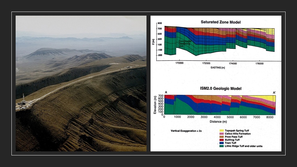
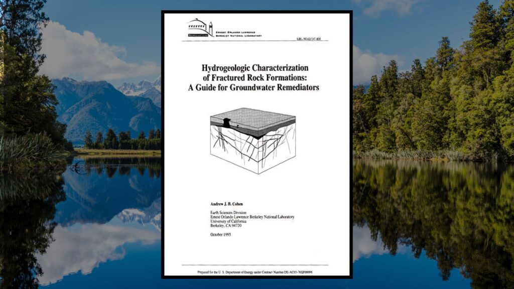
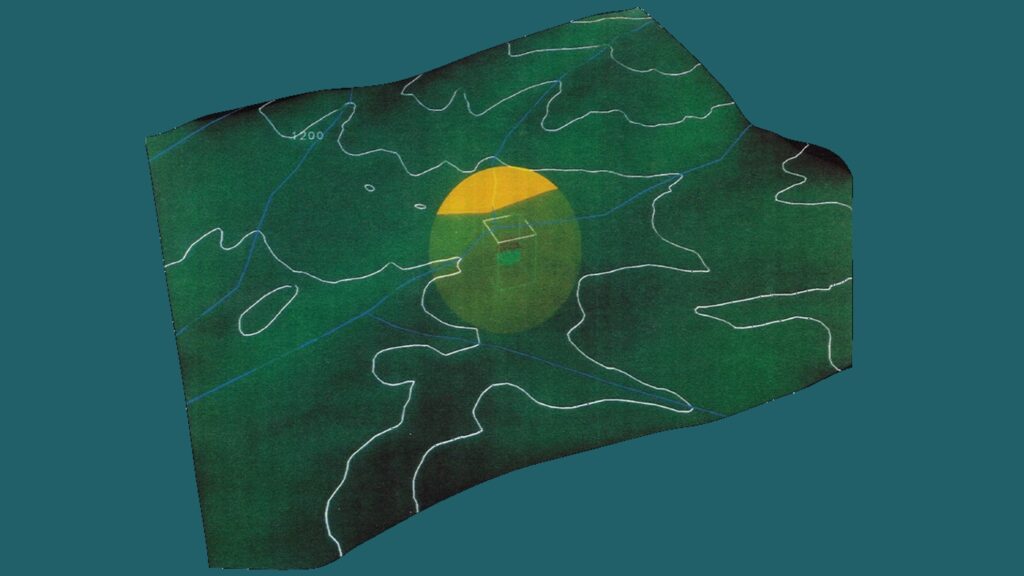
By Andrew J.B. Cohen, 1995.   This guidance report describes, compares, and provides recommendations for using and integrating different characterization methodologies, including surface and subsurface fracture detection and measurement, well drilling, pumping, injection and tracer tests, geophysical logging, borehole flow logging, seismic imaging techniques, and computer visualization techniques.   Overview   A field site was

Author: Hydrogeologic Characterization of Fractured Rock Formations – A Guide for Groundwater Remediators Read More »